

Courtesy of Alberta Wildfire:
The wildfire danger is very high in the High Level Forest Area. The Fire Ban and Off-highway vehicle restriction remain in effect. The Area received a slight reprieve in fire activity due to scattered rain showers however, the amount was not significant enough to soak the forest floor. These conditions have allowed firefighters and aircraft to operate safely.
WILDFIRE DANGER
When measuring the fire hazard, Alberta Wildfire considers many different factors including temperature, moisture in the air (humidity), wind speed and how dry ground conditions are.
Alberta Wildfire uses a variety of tools to identify areas with a high wildfire danger, and strategically places resources where they are needed most to efficiently respond to new wildfires as they occur.
HIGH LEVEL FOREST AREA WILDFIRE UPDATE| MAY 25, 2023 AS OF 11:00 AM
There are five wildfires in the High Level Forest Area. Of these fires, two are classified as out of control (OC) and three are under control (UC). To see a map of the wildfires in the High Level Forest Area and across the province please click here.
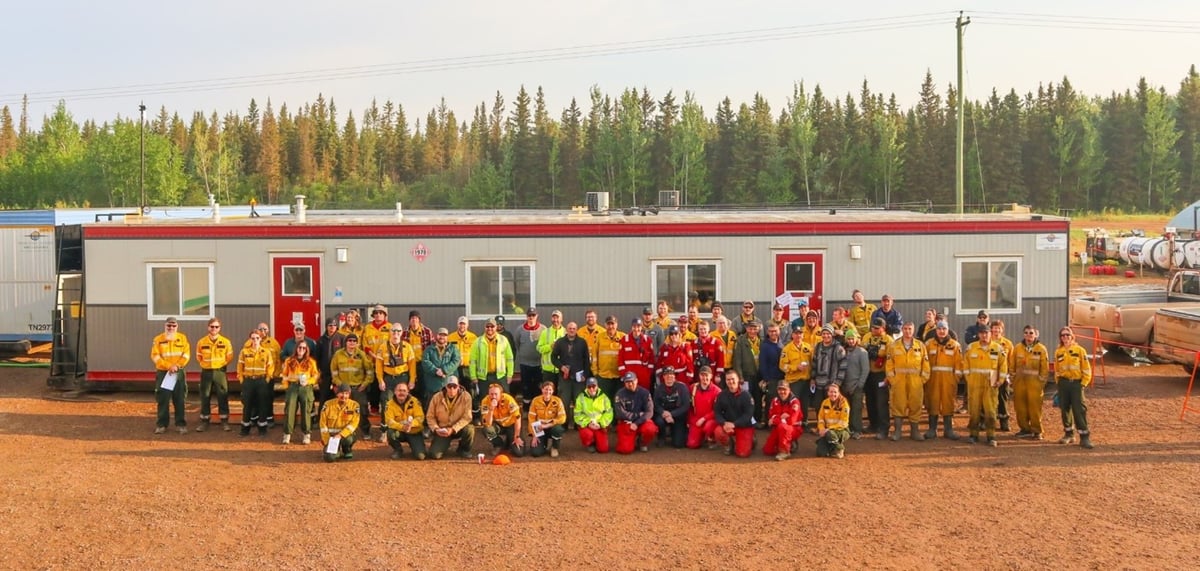
Members of the Incident Management Team and crew leaders working on the Paskwa Fire (HWF030) pose for a photo at the morning briefing, May 25, 2023.
THE LONG LAKE FIRE | HWF036 | MAY 25, 2023 AS OF 11:00 AM
This fire is located in the vicinity of the Town of Rainbow Lake. This wildfire is classified as out of control (OC) with a last recorded size of 121,846 hectares. Even though there was a slight reprieve in some areas due to scattered light showers conditions remain dry on the forest floor and we are expecting an increase in fire behaviour as the sun returns and temperatures rise. As of this update, this wildfire remains approximately 13 km from the community of Chateh.
Firefighters’ top priority is the safety of the Town of Rainbow Lake, the community of Chateh, and oil and gas and energy infrastructure. Wildland firefighter crews and wildland urban interface crews continue to monitor and patrol properties and the structures within the Town of Rainbow Lake, the community of Chateh and the Silver Tip Open camp until evacuation orders are rescinded, power lines re-energized and communications are re-established.
Incident objectives include, ensuring containment around the Town of Rainbow Lake for the duration of the incident. The fire line is being secured to limit easterly spread to the community of Chateh and other infrastructure. Firefighters continue to patrol and monitor control lines around the west side of Chateh.
There are 101 firefighters, nine helicopters and heavy equipment working on the Long Lake Fire. Structural protection crews will continue protecting structures within the area as the wildfire situation evolves.
The Town of Rainbow Lake has an evacuation order in place.
Dene Tha First Nation has an evacuation order in place for the community of Chateh.
Please stay informed by downloading the Alberta Emergency Alert mobile app or by visiting their website.
Weather Forecast | Long Lake Fire (HWF036)
Smoke coverage continues to be variable from the Long Lake fire, fires from central Alberta and eastern British Columbia. Today the forecast is as follows, a temperature of 21 degrees, a relative humidity of 30-35 percent with southwest to southeast winds 10 km/h. The reprieve in rain was only on some parts of the fire and was not widespread enough to soak the forest floor. With the rise in temperatures there will be a return in active fire behaviour.
THE PASKWA FIRE | HWF030 | MAY 25, 2023 AS OF 11:00 AM
The Paskwa fire is located in the community of Fox Lake and was detected on May 2, 2023. This fire is classified as Out of Control (OC) and the last recorded size is 73,936 hectares. The fire is inside the Wood Buffalo National Park boundary and is approximately 8km from the community of Garden River.
Today, crews will continue work to secure the northeast perimeter of the fire working along the retardant line on the flank closest to the community of Garden River. Crews have been working to extinguish 30–60-feet along the perimeter from the oxbow to the Peace River. Bucketing work will continue on the east side of the oxbow where the fire has been moving into slash and old burn areas
Enough progress has been made on this task that yesterday, the Incident Management Team made the recommendation that the evacuation alert in place for Garden River be downgraded from 24-hours to 72-hours. There are still some areas of the perimeter that need to be fully secured before a full lifting of the alert can be recommended.
Many hotspots have dug deep into the ground in the community of Fox Lake and significant work remains to fully extinguish the fire in this area. Crews are working to create an extinguished perimeter of approximately 30 metres around every structure in the community of Fox Lake. This objective will take time given the number of structures in the community.
Last night, an infrared drone camera re-scanned part of the community. The new imagery shows that crews are making significant progress in extinguishing hot spots, though many still remain.
ATCO crews have been working in Fox Lake to restore power and repair damaged lines.
Today, a new Incident Management Team will arrive and take over command of the Paskwa Fire. The two teams will have a full day of transition together on May 25th.
There are 91 firefighters, 9 helicopters, and heavy equipment working on the Paskwa fire. Air tanker support is available as requested.
Little Red River Cree Nation has an evacuation order in place for the community of Fox Lake. The community of Garden River remains on an evacuation alert. For information regarding the evacuation, please stay informed by visiting the Little Red River Cree Nation’s Facebook page.
Weather Forecast | Paskwa Fire (HWF030)
No precipitation is anticipated for the coming days. Today, the forecast is as follows, a temperature of 22 degrees and relative humidity of 25 percent, with northwest winds of 15km/h.
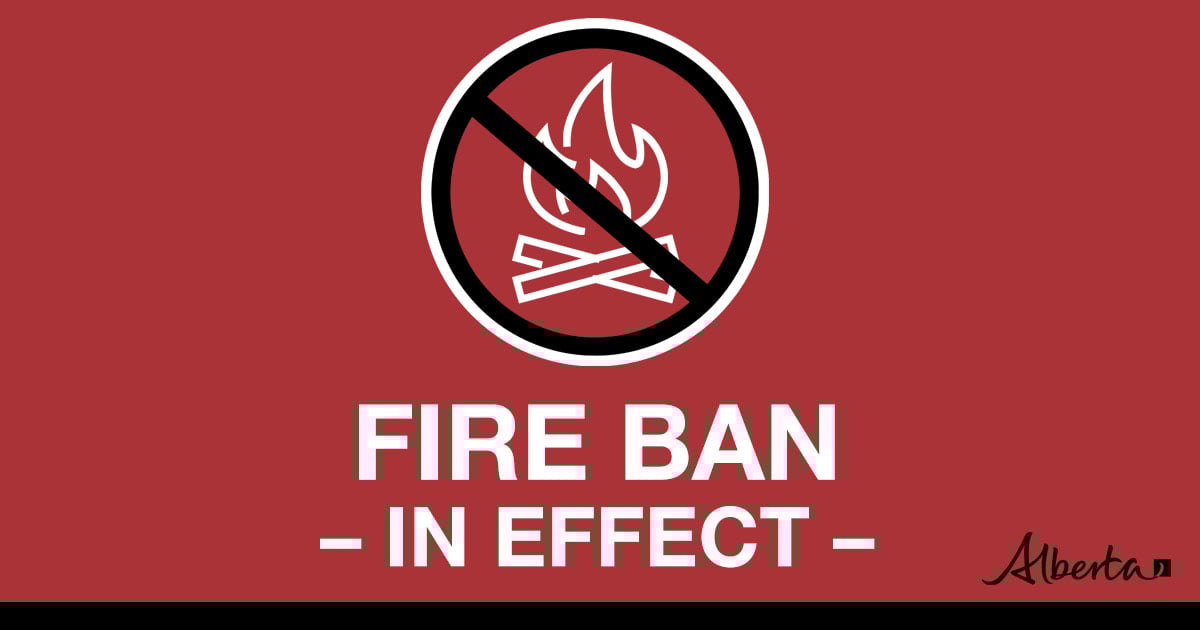

Under this fire ban:
•All existing Fire Permits are suspended (or cancelled)
•No new Fire Permits will be issued
Prohibited:
•All outdoor wood fires are banned, including wood campfires on public lands, wood campfires on private land and provincial campgrounds
•Backyard firepits
•BBQ charcoal briquettes
•The use of fireworks and exploding targets
•The recreational use of off-highway vehicles (OHV) on public lands, including designated OHV trails
Allowed:
•Propane/natural gas-powered appliances
•Open flame oil devices (e.g., turkey deep fryers, tiki torches)
•Indoor wood fires contained within a device with a chimney and spark arrestor
•All appliances must be CSA approved and used per manufacturer’s standards
•Indigenous people when using an OHV for traditional purposes. Traditional purposes are hunting, fishing, and trapping – including the use of an OHV to travel to the location(s) for these purposes.
•Essential industry-related activities requiring the use of OHVs.
•Off-highway vehicle use is still permitted on private lands.
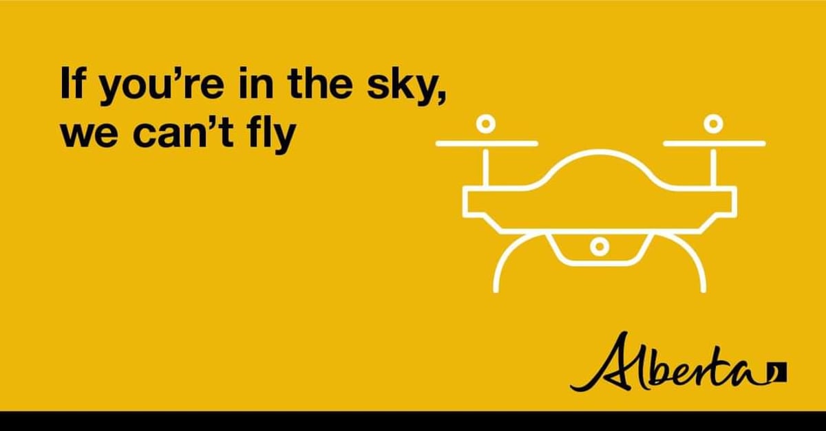
DO NOT FLY DRONES NEAR WILDFIRES!
The use of recreational drones over wildfires in Alberta is dangerous, illegal and could result in a fine of up to $15,000* for putting aircraft and people at risk. Please give Alberta firefighters the space they need to do their jobs safely.
*Transport Canada
ALBERTA STATE OF EMERGENCY
A provincial state of emergency has been declared. Albertans who require assistance can call 310-4455 for wildfire related information.
WILDFIRE INFORMATION
Download the Alberta Wildfire app today and get access to accurate, real-time information on wildfires in your area. You can also find information on fire advisories, restrictions and bans across the province and much more all on your mobile device. Available for Apple and Android.
Before heading out, please check albertafirebans.ca to determine whether there are any fire advisories, fire restrictions or fire bans in effect for your destination.
Subscribe to the High Level Forest Area Update to receive an email when new information is posted. Join the conversation on Facebook, Twitter or Instagram.
WILDFIRE LINKS AND TOOLS
Volunteers, equipment owners/operators or firefighters looking to assist with these wildfires or any of the wildfires within the province can contact EmergencySupportOffers@gov.ab.ca.
There are multiple EVACUATION ORDERS & ALERTS in the Province. Please visit Alberta Emergency Alerts or your community webpage for more information.
For road closure information, please visit: 511.alberta.ca
The NASA FIRMS Fire Information website is a great resource to give an idea of the location of wildfires in the area, but it should be noted that this data is based on interpolation and often can make a wildfire appear larger than it actually is.
Wildfire smoke is a tool used for the location of smoke firesmoke.ca
To see all the wildfires burning in Alberta click here.