

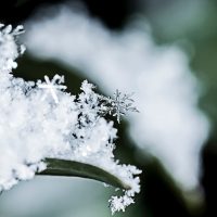
People across the region are bracing for an early snowfall which is expected to hit us on Wednesday.
Last week was when we first learned we’d be getting snow on Wednesday, and Environment Canada Meteorologist Dave Carlsen explains it’s looking like that forecast will stick.
“Well, this week it’s going to rain on and off until about Tuesday night,” says Carlsen. “Tuesday night and Wednesday, mostly wet snow is what we can expect.”
Carlsen says Peace River can expect at least 2 to 4 centimetres of snow on Wednesday, and an increased amount of snow heading west close to the B.C. border.
Compared to last year, we’re getting our first taste of winter over a month in advance.
“Looking back in the records, there was brief snow reported on early morning of October 22 last year, but the first snowfall that was really noticeable was October 24,” says Carlsen.
If you’re not quite ready for winter yet, there’s some good news: the snow won’t be sticking around for very long. Carlsen notes temperatures are expected to increase and we should see the snow disappear within a couple days.
“The snow’s not going to stick around for very long. It really depends how much exactly falls. If it’s a couple centimeters then I would expect that by Thursday afternoon it’ll be gone. As we get toward the end of the week, temperatures are going to be getting up to about 10 degrees for highs, and that’ll be certainly enough to melt any snowfall by then.”
-JD