


Courtesy of Alberta Wildfire:
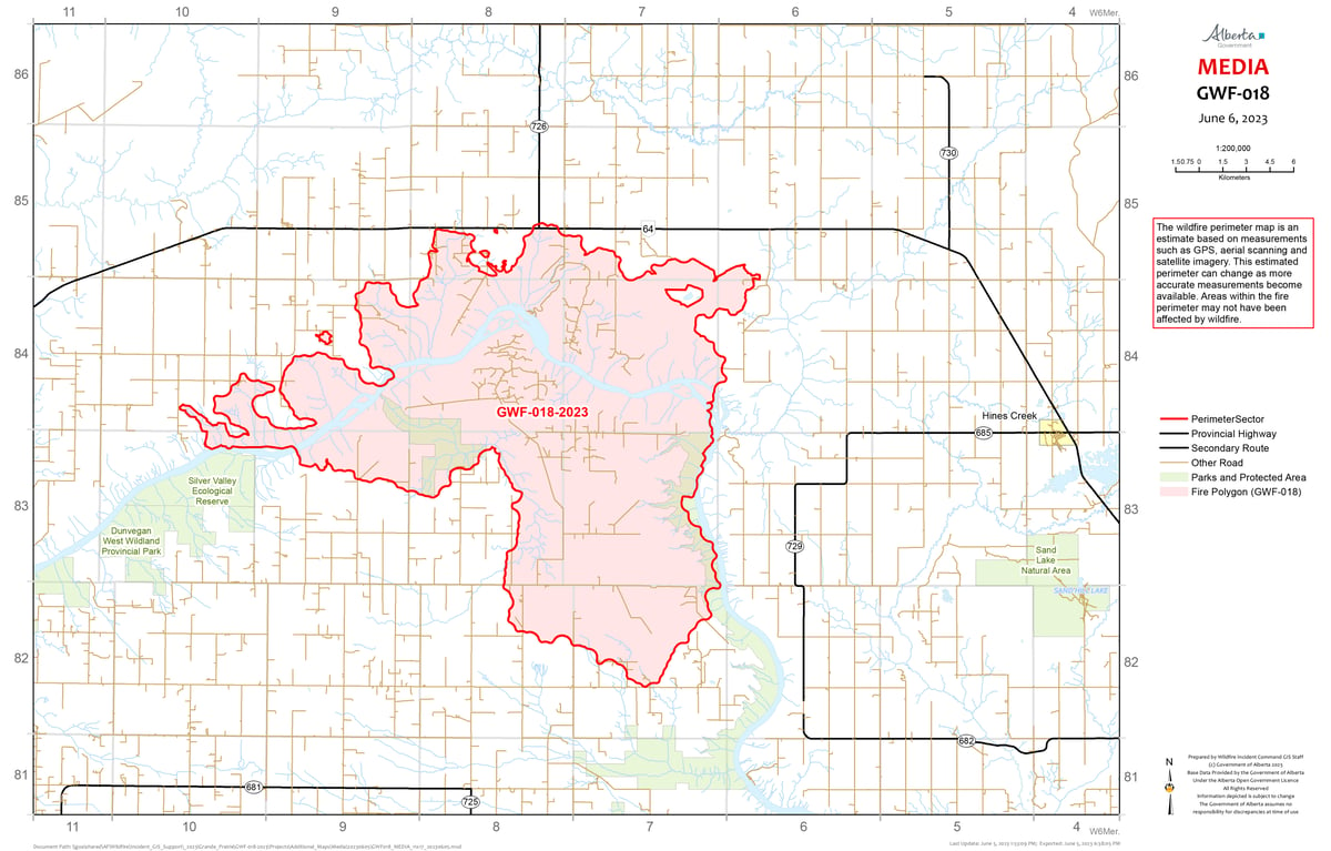
GWF018 is currently classified as Out of Control (OC). It is now estimated to be 48,500 ha in size. Wildland firefighters, assisted by heavy equipment and helicopters, are working on containing a 65-ha excursion in the east side of the river valley, which was detected two days ago. Containment lines are holding the excursion, and wildland firefighters are actively working and patrolling the area. The northeast flank of the fie was very active yesterday, but also holding within established containment lines. Smoke will be visible again today, but please do not report smoke or flame from within an active wildfire area.
The Kimiwan Complex Fire SWF068 is classified as Out of Control (OC). The current fire size is 126,196 ha.
Over the last couple of days, firefighters have taken advantage of the cooler weather to prepare guard lines prior to ignition operations, which will burn out the unburnt areas of forest north of Seal Lake Road and west of Noel Industry Road. Today the ignition line will be lit from the guard lines. Containment of the burn will be supported by aircraft including an airtanker and helicopters with buckets.
Firefighters supported by aircraft will also continue to reinforce and lengthen containment lines and put out hotspots around the southern and eastern perimeter of the fire.
We ask community members to refrain from driving on the Seal Lake Road west of the intersection of Range Road 190.
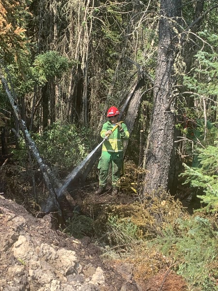
An Australian wildland firefighter on SWF068.
PWF038 is now classified as Under Control (UC) and 100 per cent contained.
An Australian Incident Management Team is managing the Peace River Forest Area (PRFA) Kimiwan Complex which includes both (SWF068 and PWF038) fires. The Incident Management Team is supported by firefighters from Canada, Australia and America.
The Kimiwan Complex Information Officer is Carmel Henderson 780-652-2410.
For more information about wildfire in or near municipalities impacted by SWF068, please go to Northern Sunrise County or the MD of Smoky River
HWF058 is located approximately 80 km southwest of the Town of High Level and approximately 23 km northwest of the of Paddle Prairie Metis Settlement boundary marker, east of the Chinchaga River. This fire is classified as out of control (OC) at 3,079 hectares. There are 25 firefighters, 1 helicopter and airtankers are available as needed. Yesterday the fire saw growth towards the east and southeast due to the west winds. In addition, the winds shifted yesterday evening coming from the north, therefore there fire saw growth to the south as well. There is no threat to any communities at this time. For more information, please visit the High Level Forest Area Update